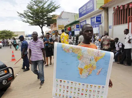
The African Union (AU) has thrown its weight behind a campaign urging governments, schools, and international organisations to abandon the centuries-old Mercator world map in favour of a projection that accurately depicts Africa’s scale.
The 16th-century Mercator projection, developed for maritime navigation, has long been criticised for distorting landmass sizes—enlarging regions near the poles while shrinking Africa and South America.
AU Commission Deputy Chairperson Selma Malika Haddadi told Reuters the map subtly reinforces Africa’s marginalisation despite it being the world’s second-largest continent, home to 54 nations and over one billion people.
“It might seem to be just a map, but it is not,” Haddadi said, noting that the projection shapes global perceptions, influencing education, policy, and even international diplomacy.
The AU sees correcting this as part of a broader agenda to “reclaim Africa’s rightful place on the global stage,” a narrative that also ties into calls for reparations for colonialism and slavery.
The ‘Correct The Map’ campaign—led by advocacy groups Africa No Filter and Speak Up Africa—promotes the Equal Earth projection, designed in 2018 to display countries’ true proportions.
Campaign leaders argue that the Mercator map undermines African identity and pride, particularly in early education.
Efforts are already underway to introduce the Equal Earth map into African classrooms and lobby for its adoption by institutions such as the United Nations and the World Bank.
The Caribbean Community (CARICOM) Reparations Commission has also endorsed the initiative, framing it as a rejection of “ideologies of power and dominance” embedded in cartography.
The AU plans to coordinate member states on adopting the Equal Earth projection while advocating its use in global forums, seeing it as both a symbolic and strategic step in reshaping Africa’s geopolitical narrative.
Leave a Reply